
St. Joseph County Address Eras
The strongest trail changes with the date. Current assessment cards identify the parcel and point toward recent transfers. Recorded deeds carry the legal ownership chain much farther back, while directories and census schedules add the people who actually used the address. A property owner and a resident may be different people, so previous residents should be supported by an occupant source whenever possible.
| Local source | Years located | Where to use it | Best evidence |
|---|---|---|---|
| Deed indexes and books | 1830 onward; online span disputed | Recorder, terminals, microfilm, State Library | Grantor, grantee, legal description, instrument |
| South Bend directories | 1882/1883 through 2015, with gaps | SJCPL, State Library, History Museum, scans | Dated occupant, address, work and removal note |
| Mishawaka directories | Early 1900s onward; 1971-2005 warning | SJCPL, State Library, History Museum | City-specific address and occupant entries |
| Federal census | 1850-1950 public | NARA and library databases | Household, age, birthplace and relationship |
| Sanborn maps | Local access for 1867-1970 | SJCPL and State Library | Footprint, material, use and house number |
| Obituary and probate | Obituary index from 1913; court series vary | SJCPL, SBAGS, Archives, Clerk | Relatives, addresses, heirs and case clues |
Choose the source closest to the target year. For a recent sale, begin with the Assessor and Recorder. For an early South Bend household, pair a directory entry with a census page or newspaper item. A Mishawaka search must respect the State Library guide's warning that South Bend-only volumes from 1971 through 2005 do not cover Mishawaka.
Start Previous Residents With Parcels
The free XSoft property search accepts an owner, address, or property number. Its parcel card separates the situs address, which identifies the property, from the mailing line used for tax correspondence. Copy the parcel ID, legal description, subdivision or lot, transfer dates, and any recorded reference. Those fields survive spelling shifts and street-number problems better than a name alone.
The inspected New Carlisle card showed a parcel ID, a two-lot legal description, township and taxing district, owner label, mailing line, neighborhood code, and transfer history. It did not prove that each named owner lived there. Use the card as a dated assessment snapshot and a bridge to deeds, not as a complete list of past residents.
- Situs address
- The street location assigned to the parcel, distinct from the owner's mailing address.
- Legal description
- The lot, block, subdivision, or metes-and-bounds wording that identifies land.
- Parcel ID
- The county property identifier linking the assessment card, map, and deed index.
Walk St. Joseph County Deeds Backward
A deed chain follows legal ownership, not every person who stayed in the house. Begin with the latest known owner and keep the legal description fixed while walking backward. St. Joseph County offers Tapestry and Laredo, plus appointed public-computer sessions at the Recorder's office. Paper, microfilm, and older deed books remain part of the search when an image is absent online.
- Copy the owner, parcel ID, legal description, transfer date, and recorded reference from XSoft.
- Search by parcel, tract, subdivision, owner, document number, and date. Test name variants.
- Open the newest deed and record parties, instrument, type, date, legal description, book/page, and cross-references.
- Treat the current owner as grantee and the prior seller as grantor. Search that seller as an earlier grantee.
- Repeat until online coverage ends, then use terminals, books, microfilm, or a focused request.
- Grantor
- The person or entity transferring an interest in land.
- Grantee
- The person or entity receiving that interest.
- Chain of title
- The linked sequence of recorded transfers for the same land.
The Recorder is at 227 W. Jefferson Boulevard, Room 321, South Bend. Public computer sessions require an appointment and last one hour. A portal miss does not establish a break in ownership, since the record may sit in an older index or under changed land wording.
The St. Joseph Index Dispute
The online starting point needs a date label. The current Laredo landing page says its index and images begin in January 1992, while an official 2018 county agreement states a January 1977 start. The research did not resolve that conflict. Treat both as published claims and ask the Recorder which years and image types are available now.
Older records are not lost merely because a portal returns nothing. The State Library guide lists deed indexes from 1831 through 1899, early volumes beginning in 1830, and later deed runs into the early twentieth century. County copies are listed at $1 per page; Tapestry lists an $8.75 search and separate image charges.
Pair St. Joseph Directories and Census
Owners are only half the address story. A dated directory entry can show a resident, boarder, widow, business, or rural-route connection. Census schedules can then show the household around that person. The St. Joseph County city directory collections give the full shelf details; for an address trail, extract the entry, page, year, publisher, and abbreviation key.
- Find the address in a street section, then check each named person in the alphabetical section.
- Save the year, page image, spelling, abbreviation, and any removal, spouse, work, or boarding note.
- Compare nearby years. Do not assume an alphabetical volume has a reverse-address section.
- Pair the closest public census and record the enumeration district, household, relationships, and page.
- Require a second clue, such as work, spouse, age, obituary, or legal description, before joining names.
The public census reaches 1950 under the 72-year release rule. A census is a snapshot, not continuous proof. Keeping records separate makes gaps visible and stops a common name from being stretched across decades.
Map St. Joseph Address Changes
Old street numbers cannot always be read as modern ones. No verified countywide renumbering schedule was found, and the 1883 directory carries errata and removals. When a number changes, compare intersections, lot and subdivision text, adjacent parcels, street-index order, and map block numbers. Never translate an old address from a commercial map alone.
Sanborn sheets add building footprints, materials, height, use, street width, and house or block numbers. SJCPL provides library-card access to local sheets from 1867 through 1970, subject to available editions. A persistent footprint is useful continuity evidence, but it does not name previous residents or establish title.
County aerials extend the map trail. The GIS request form lists aerial years from 1966 through 2025. A selected tile can show when a drive, alley, road edge, or structure changed, yet it remains map evidence only.
Human Help for Previous Residents
SJCPL's Local and Family History room combines directories, newspapers, yearbooks, church records, microfilm, Sanborn access, genealogy databases, Michiana Memory, and the local obituary index. Its narrow query service can search an obituary, marriage clue, news item, or directory page when a name, place, question, and date range are supplied. Outside-county research is listed at $10 per hour with a $5 minimum, normally taking one to four weeks.
The Vincent Bendix Research Library at the History Museum holds survey cards, ownership histories, photographs, blueprints, maps, plat books, deeds, abstracts, architectural drawings, and newspapers. Its reading room at 808 W. Washington is open weekdays, 10 a.m. to noon and 1 to 5 p.m.; appointments are recommended. Much remains available by request rather than through a complete web index.
The successful capture below comes from the digitized 1883 William L. Farr directory.
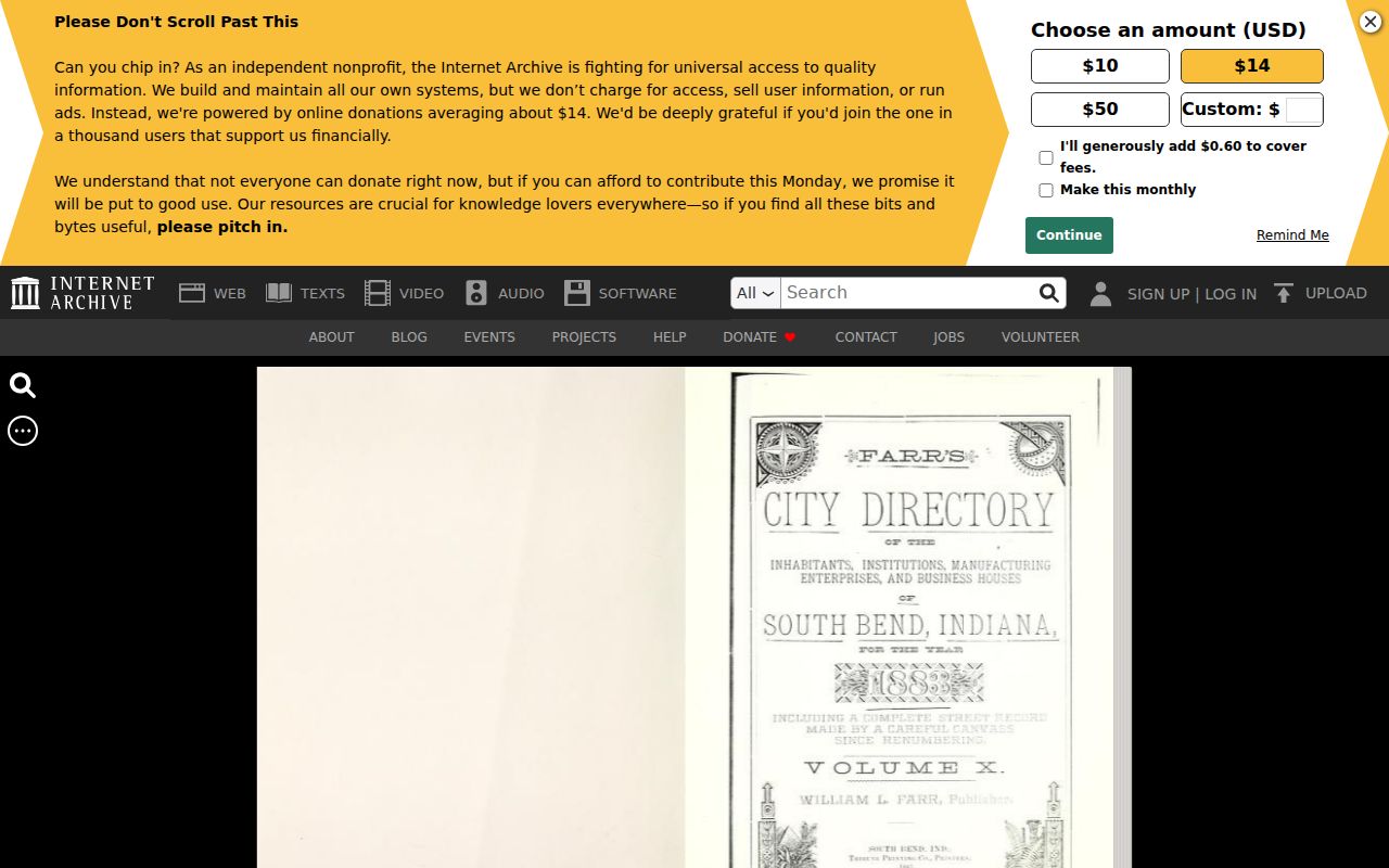
The scan lets researchers check the page, abbreviation key, street section, and errata instead of trusting OCR alone.
Close a St. Joseph Household Trail
An obituary may supply relatives, a former address, church, funeral home, group, or burial place. A will or estate index may identify heirs, a fiduciary, land, or a cause number. SJCPL's obituary index starts mainly with the South Bend Tribune in 1913; earlier deaths call for newspapers, cemetery and church sources, probate material, and death registers.
Search the SJCPL obituary index with a known date range, then request the full item for a plausible hit.
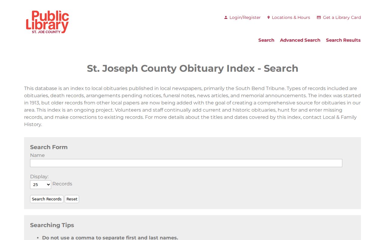
The index is a finding aid. Cite the newspaper or source record obtained from library staff, and use the Clerk or Archives file when probate evidence is required.
A sound chain reads parcel and legal description, deed index or book, dated directory, census or Sanborn sheet, then obituary or probate. Record the page, instrument, date, and custodian at each step. That method answers who lived here before without turning gaps into a story.
Lawful use. Research previous residents for house history, family history, estate work, or personal curiosity. Never use an address trail to watch, harass, or harm a living person.