
Walk a St. Joseph County Street
Begin with the most exact form of the address available. A postal address can find the parcel, but the parcel number and legal description make the stronger link between systems. The assessed owner is a lead, not a claim about every person who lives there. The county street directory process works best when each result keeps its source and date.
- Enter the full address in the XSoft Engage assessment search. If it misses, shorten the street text or search the property number.
- Open the lot on the Assessment Neighborhood Map. Note the parcel boundary, taxing neighborhood, city or township line, and parcel-card date.
- Use the county GIS Parcel Search to follow the street and record each adjacent parcel ID manually.
- Carry the owner, parcel, subdivision, and legal description into the Recorder's land-record systems. Follow the newest deed from grantee to prior grantor.
- For a dated occupant rather than an owner, check the street section of an old directory, then confirm the name in the alphabetical section and another dated source.
This chain separates mapped land, assessed ownership, recorded title, and historical occupancy. Those facts often overlap, but they are not interchangeable. Individual registration can be checked through Indiana Voters, while a full voter file has legal use limits and is not an open street roster.
Write down the result even when it is negative. A portal failure, blank image tab, missing directory year, or address with no map hit calls for a different access channel. It does not prove that the record never existed. Try the office terminal, custodian request, Archives, library microfilm, or a neighboring parcel before closing the search.
St. Joseph Street Search Fields
The county assessor provides the fastest current address entry point. Its search controls are simple, but the opened card is detailed. Tabs may include the summary, sketch, transfer history, sales, valuation, taxes, land, improvements, neighborhood amenities, documents, street view, and forms. A blank tab only means that the inspected card has no displayed data in that category.
| Control | Input | Best use | Result note |
|---|---|---|---|
| Owner | Name text | Find parcels tied to a known assessed owner | Test surname and joint-name variants |
| Address | Street text | Open the situs parcel | Shorten or normalize street terms after no hit |
| Property Number | Parcel or tax ID | Bridge the card to GIS and deeds | Strongest cross-system key |
| Map and Data | Action tabs | Switch from search to mapped context | Parcel geometry is not a survey |
| Action button | Save the dated card or map view | Cards update on an annual cycle |
The manifest capture from the assessment search resources shows the official portal context used for this address workflow.
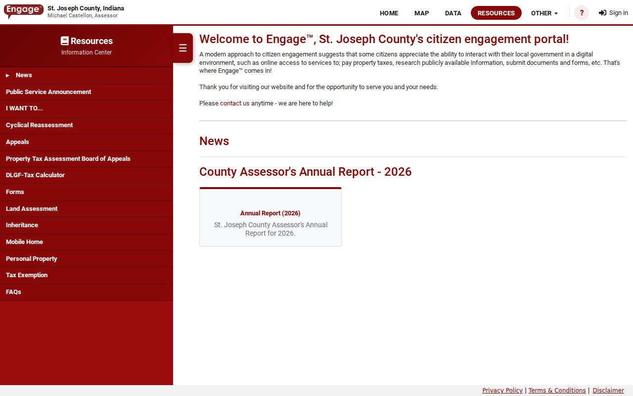
The screen is a route into a parcel card, not proof that the mailing-name line describes the current household.
An inspected St. Joseph County card can also show neighborhood, tax district, school corporation, class, utilities, topography, transfer dates, and a legal lot description. These fields help distinguish two similar addresses. Copy them exactly with the date viewed, since current assessment data and annual cards can change.
St. Joseph Records by Address
No single St. Joseph County street directory contains every relevant fact. Each custodian answers a narrower question. Online tools should be paired with office terminals, requests, microfilm, and library help when older material or a portal gap matters.
| Address source | Custodian | What it establishes | Access route |
|---|---|---|---|
| Assessment card | County Assessor | Owner label, situs, mailing line, parcel, legal description | Free XSoft portal |
| Parcel map | County GIS | Lot geometry, nearby parcels, public boundaries | Free map viewer |
| Recorded instruments | County Recorder | Grantor, grantee, deed type, date, instrument and legal land | Limited search, Tapestry, Laredo, office terminal, books and microfilm |
| Tax bill | Auditor and Treasurer | Billing, tax history and delinquency context | Name, address or parcel search |
| City case or GIS | South Bend departments | Address points, districts, project or violation clues | LandRecords, Citizen Access or a narrow APRA request |
| Historic street entry | Library, State Library and museum | Dated resident, business, occupation or rural-route clue | Scans, shelves, microfilm and staff lookup |
For records not indexed online, contact the custodian with the complete address, parcel number, legal description, record type, and date range. South Bend requests must describe the record with reasonable particularity. City files and county property records remain in different offices.
The Auditor and Plat Room are key fallbacks when a deed was just recorded or a parcel changed shape. Current-owner data is generally about one day behind an event, and Plat Room updates are generally one to three days behind recording. Splits, consolidations, transfer stamps, rights-of-way, and vacated roads can explain why an older instrument will not match today's street search.
Map St. Joseph Streets Carefully
The Assessment Neighborhood Map can search a tax ID or address, open a parcel popup, and toggle parcel and taxing-neighborhood layers. County GIS adds adjacent geometry and more public layers. A verified automatic radius or buffer tool was not found, so a block search requires clicking each lot and recording each parcel ID. Street labels, municipal lines, townships, tax districts, and postal cities can disagree.
The official assessment neighborhood map was successfully captured for the street directory.
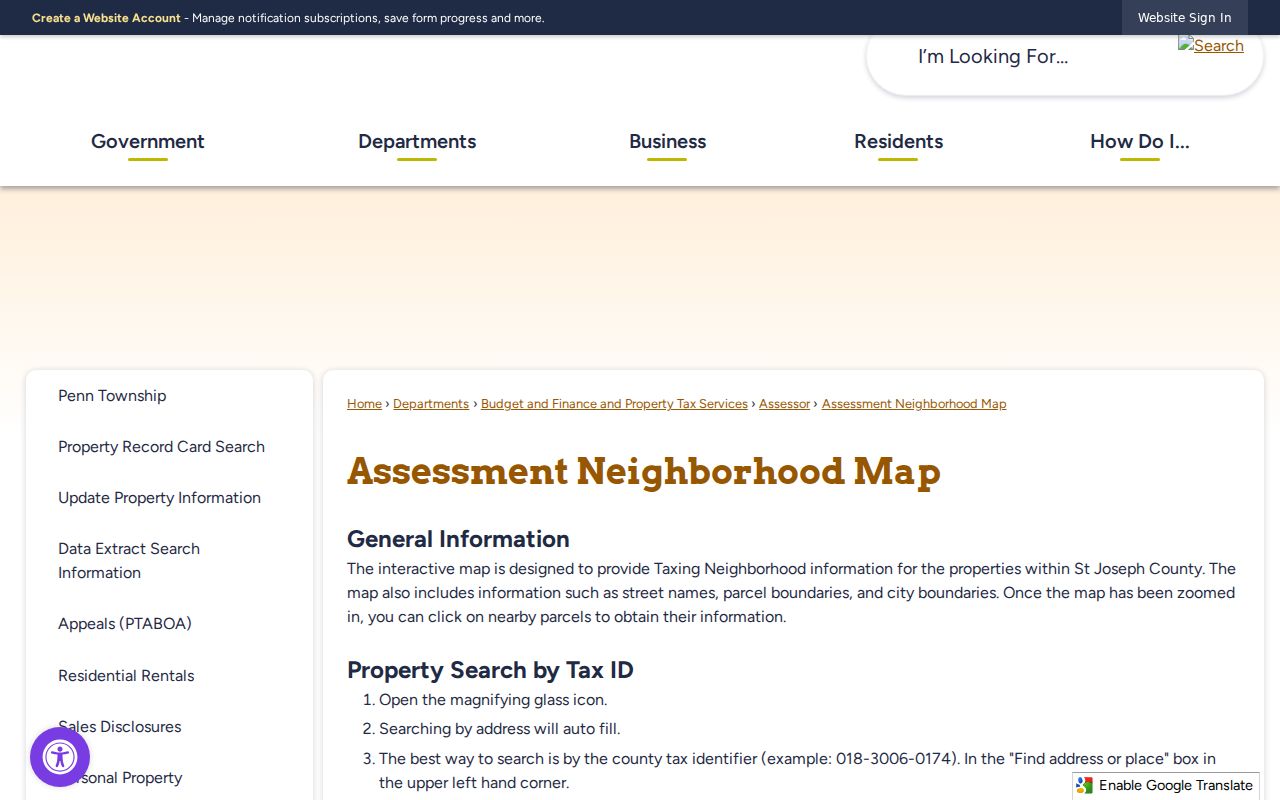
Use its labels as mapped context, then open the parcel card and deed rather than treating the map popup as a full ownership record.
Keep the identifiers. A parcel ID and legal description are a safer bridge to older deeds than a street number alone.
St. Joseph Address Terms
A few record words prevent the most common street-search errors. Define them before copying names from one public system into another.
- Parcel
- A mapped unit of land identified for assessment. One mailing address may involve more than one parcel.
- Situs address
- The property location shown on the assessment card. It differs from the tax mailing destination in some records.
- Plat
- A recorded map that divides land into lots, blocks, streets, easements, or other legal features.
- Criss-cross directory
- A directory section arranged by street and house number rather than by a person's surname.
Legal descriptions can use lots, blocks, subdivisions, plat books, or metes and bounds. When an old address changes, compare that description with neighboring parcels, a Sanborn block number, and the street index instead of guessing a modern number.
Follow St. Joseph Deeds
The St. Joseph County Recorder holds deeds, mortgages, liens, plats, easements, releases, and other permanent land documents. Tapestry can search first and last names, beginning and ending dates, consideration, document number and type, tract, subdivision, and parcel. The current county landing page says index and images begin in January 1992, while an official 2018 Laredo agreement describes a January 1977 start. Verify the active cutoff before promising an older online result.
Read the newest deed as a direction. The current owner is normally the grantee, and the prior seller is the grantor. Search that seller as an earlier grantee while holding the same legal description. Record each instrument number, date, type, book and page, parcel, consideration, and cross-reference. A split, consolidation, vacated alley, or new plat may change the path.
When the online chain ends, use the Recorder's public computers and permanent records. Computer sessions require appointments, run for one hour, and are unavailable from noon to 2 p.m. Older books and microfilm remain necessary. Tapestry lists an $8.75 search, with image charges, while county copies are listed at $1 per page.
South Bend Street Records
Inside South Bend, city systems add address points, city limits, council districts, inspector areas, historic-preservation layers, school boundaries, and code-case clues. They do not replace the county assessment card or the Recorder's deed. Municipal files can identify a project, violation, photograph, inspector, or responsible party tied to an address, though the live Citizen Access field list was not captured.
The South Bend LandRecords service exposes the map layers behind that city-side check.
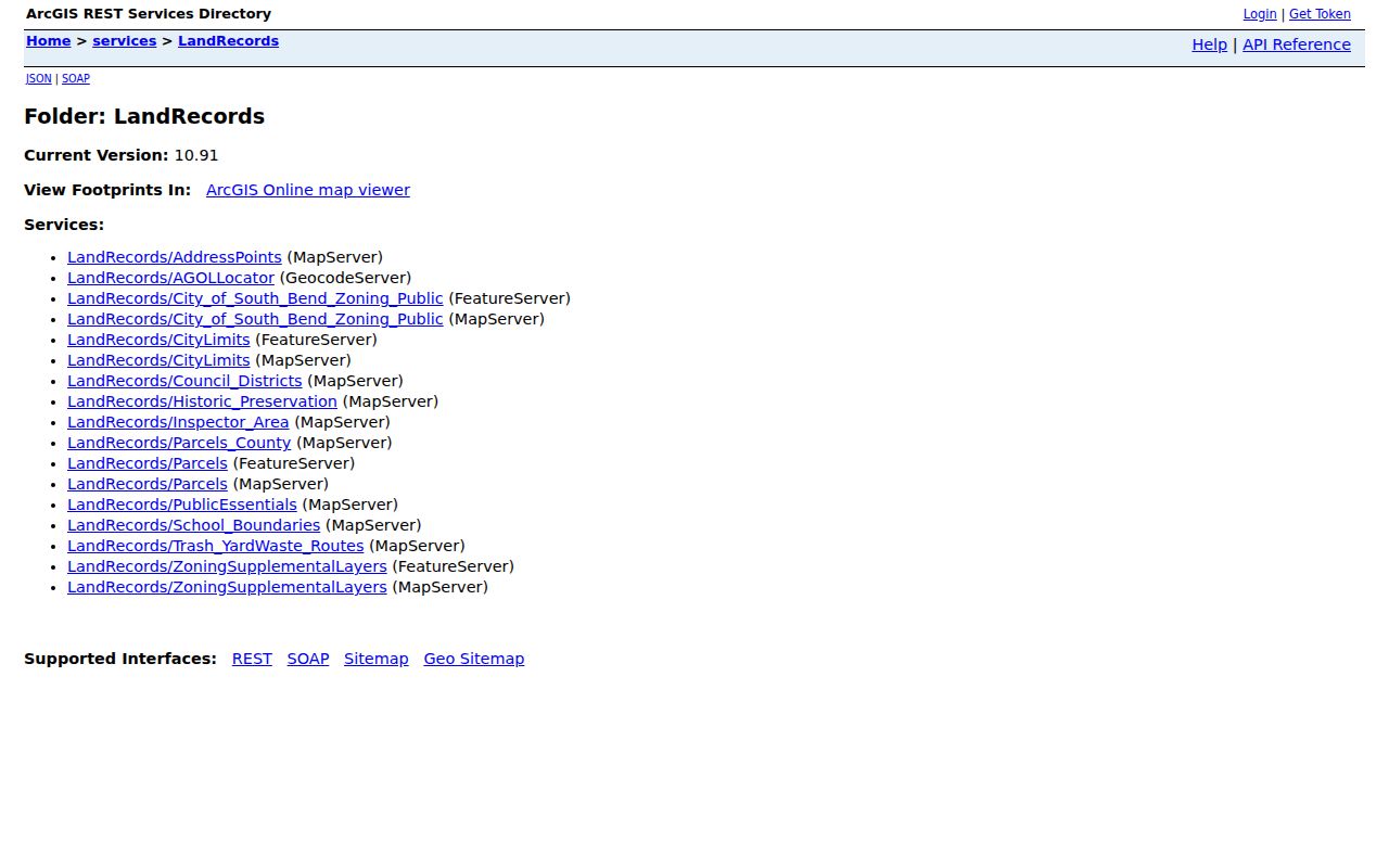
These layers help explain which city boundary or district surrounds a parcel. For the underlying file, request the relevant department's permit, inspection, survey, or code record by address and approximate year.
St. Joseph Streets Through Time
Historic city directories can turn an old house number into a dated person or business. The 1883 Farr volume includes an abbreviation key, alphabetical listings, errata, removals, and a street directory. Later Hibbard and Polk runs add more years, but no separate complete countywide reverse-directory run was verified. A volume arranged by surname should not be treated as if it supports address-first searching.
Use res. as a residence notation and bds. as boards, then read the volume's own key. Compare nearby years for a spouse, widow, trade, business, rural route, or the word removed. The fuller collection history belongs in the St. Joseph County city directory collection; the street task is to connect one dated address entry to its parcel and map context.
The Indiana State Library Sanborn map collection provides another address bridge.
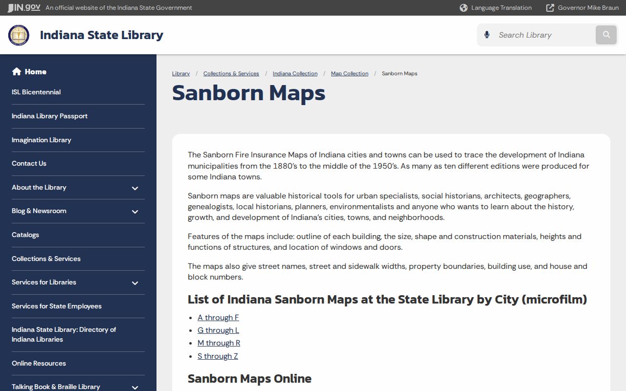
Sanborn sheets can show footprints, building use, materials, street width, house numbers, and block numbers, but not the identity of every person inside.
Request St. Joseph GIS Layers
The county's Online Data Request form offers a deeper fallback when the public viewer does not answer an address question. Available choices include address points and grids, centerlines, annexations, parcels, subdivisions, survey sections, tax districts, voter precincts, zoning, roads, rights-of-way, vacations, boundaries, flood and hydrology layers. Historic aerial choices span 1966 through 2025.
An aerial tile is listed at $25. A full-county layer requires a provisional agreement and lists a $200 charge. This is a request form, not instant download. Ask for the exact layers and years needed to test a suspected annexation, road change, alley vacation, or parcel split, and retain the response date.
The form also lists civil townships, census tracts and block groups, parks, rail lines, school districts, soils, survey sections, wetlands, flood features, and topography. Select only the layers that answer the address question. A focused request is easier to interpret than a full bundle, and it preserves which St. Joseph County layer supplied each geographic claim.
Note: GIS layers explain mapped geography, while the Recorder's instrument and legal description remain the stronger evidence for a land transfer.
Limits of St. Joseph Street Records
A public street search cannot produce a complete household list. Assessment systems expose an owner label and mailing destination, not all occupants. County tools do not reveal utility subscribers, private mail recipients, or motor-vehicle addresses. Indiana's voter portal supports an individual lookup, while protected voter records and Address Confidentiality Program information are withheld.
Directories also freeze one publication moment. A missing name may reflect a move, an unlisted person, a scope gap, a spelling choice, or a year that was never published. Likewise, a tax mailing line can point to an owner who receives bills somewhere else. Phrase conclusions narrowly: "owner on the assessment card" or "listed at this address in the 1919 directory" is sounder than asserting present residence.
Lawful personal use. Use St. Joseph County street records for genealogy, property research, civic review, or personal safety. Never use an address trail to stalk, harass, intimidate, or harm someone.