
St. Joseph ZIP Directory Map
The official county map, updated in October 2025, shows 23 ZIP polygons. They include the urban South Bend and Mishawaka areas, smaller incorporated communities, and rural polygons that reach a county edge. This county postal directory preserves every visible label, but the map is not a list of every delivery point, post-office box, or special institutional code. USPS remains the source for a current address.
| ZIP | Area Covered | Postal Label | Search Note |
|---|---|---|---|
| 46506 | Southern county edge and rural area | Bremen | Verify the exact delivery point |
| 46530 | Granger and Georgetown-area north | Granger | Community and township lines may differ |
| 46536 | Lakeville-area south | Lakeville | Use a full address |
| 46544 | Mishawaka area | Mishawaka | Keep separate from 46545 |
| 46545 | Mishawaka area | Mishawaka | Current station not separately verified |
| 46550 | Nappanee-area county edge | Nappanee | Check city and route |
| 46552 | New Carlisle area | New Carlisle | Postal city does not prove municipality |
| 46554 | North Liberty and nearby rural area | North Liberty | Do not merge nearby labels |
| 46556 | Notre Dame and nearby north | Notre Dame | Verify the delivery point |
| 46561 | Osceola and eastern county | Osceola | Polygon may cross the town line |
| 46573 | Rural east and south | Wakarusa | Verify the county edge |
| 46574 | Rural east and south | Walkerton | Keep distinct from 46573 |
| 46595 | Rural southern polygon | Wyatt | Check the current route |
| 46601 | Central South Bend and downtown | South Bend Main | Delivery and city boundaries differ |
| 46613 | South Bend south side | South Bend | Use the street to split adjacent areas |
| 46614 | South and southeast South Bend | South Bend, Chippewa | No resident list comes from a ZIP alone |
| 46615 | East and southeast South Bend | South Bend, Edison Park | Verify at address level |
| 46616 | Central and east South Bend | South Bend | XSoft has no separate ZIP filter |
| 46617 | North and east near the university | South Bend | Pair with GIS address points |
| 46619 | Southwest and west South Bend | South Bend | City mismatch is possible at the edge |
| 46628 | Northwest and west South Bend | South Bend | Check municipality and township |
| 46635 | Northeast and east South Bend | South Bend | Do not infer a neighborhood from ZIP |
| 46637 | North South Bend and Notre Dame area | South Bend | Informal campus labels may differ |
The county map supplies geography, while the Postal Bulletin provides official city labels located in the research. Neither replaces a live address query. No verified county source supplied a distinct PO-box-only polygon, special-institution polygon, per-ZIP population count, or a full history of ZIP changes, so those details should not be guessed.
Verify St. Joseph Postal Codes
The USPS ZIP Code Lookup is the first check for a live delivery address. Its address form requires street, city, and state, while company, apartment, and ZIP fields are optional. The result standardizes the mailing address and delivery code. It does not identify a resident, owner, or business occupant.
| USPS Field | Required | How to Use It |
|---|---|---|
| Street address | Yes | Enter the delivery street and number |
| City and state | Yes | Use the known postal city; select Indiana |
| Company / apartment | No | Add when it helps identify a unit or delivery point |
| ZIP | No | Use for confirmation, not to force a result |
| Find | Action | Returns standardized postal data |
For monthly ZIP, city, county, and post-office reference data, USPS also provides the Address Information System Viewer. Its official screen is shown below.
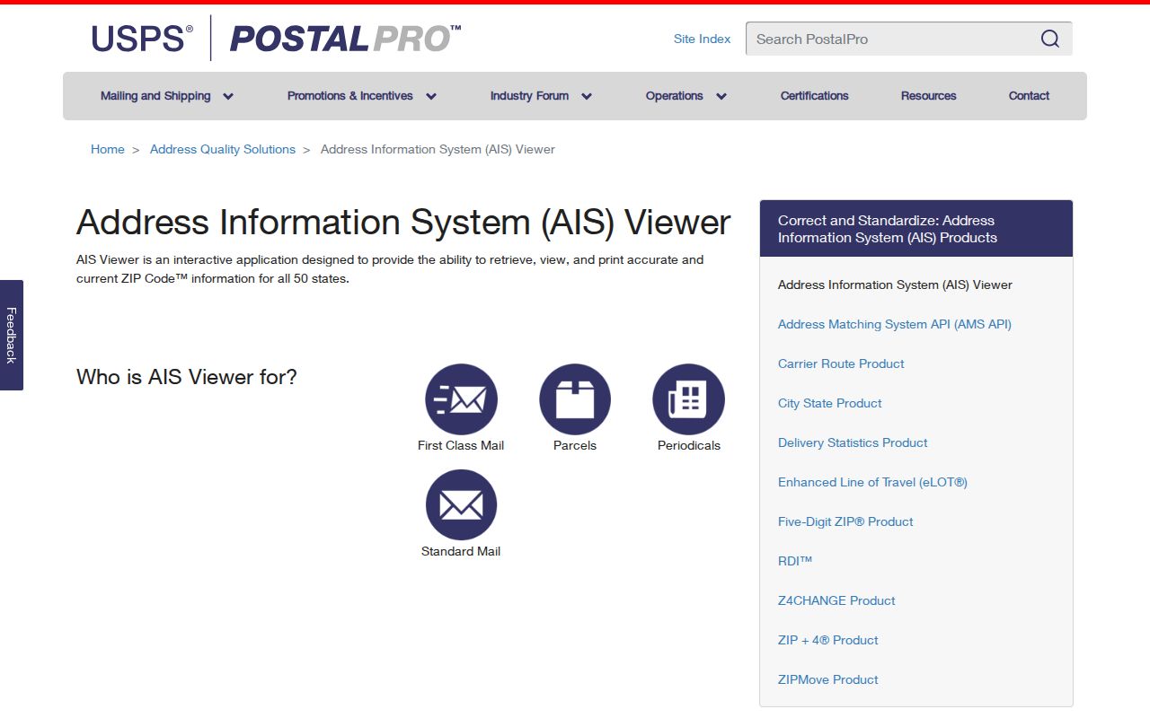
The AIS source confirms postal relationships, while St. Joseph County GIS supplies the separate parcel and government-boundary view.
Postal Labels Across St. Joseph
St. Joseph County contains South Bend and Mishawaka, seven towns, thirteen townships, and unincorporated communities such as Granger, Wyatt, and Lydick. A single research trail can therefore contain a South Bend mailing label, a Penn Township parcel, a school district, and a county tax district. None should overwrite the others.
The official USPS processing-label table offers a dated check for labels such as Bremen, Granger, Mishawaka, New Carlisle, North Liberty, Notre Dame, Osceola, Wakarusa, Walkerton, Wyatt, and South Bend. The Postal Bulletin table is useful historical support, not a substitute for current address verification.
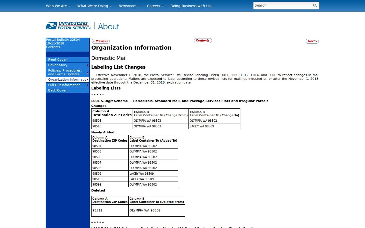
The table explains why a postal-city name can remain useful even when the parcel falls under a different town or township for public records.
Search St. Joseph Residents by ZIP
A postal directory narrows a large county, but the actual person or parcel search must move through systems built for names and addresses. XSoft places ZIP inside the address text and does not expose a dedicated ZIP-wide filter. The tax-bill route accepts a property address, while the Assessor property-information form asks for address, city, five-digit ZIP, parcel ID beginning with zero, year built, and email. Indiana's individual voter tool is not an open ZIP roster.
- Verify the full delivery address with USPS. Save the standardized city, state, and five-digit code.
- Open county GIS and locate the parcel. Record the city or town boundary, township, parcel number, and nearby streets.
- Check XSoft by property address or owner name. Keep the situs address separate from the owner's mailing address.
- Use the correct name-based record, such as the voter, court, business, or license portal, and compare a dated second source.
Once the area narrows to a road, the St. Joseph County street directory handles address and parcel work at street level. A ZIP-wide list should never be treated as proof that every named person currently lives within that postal polygon.
Match ZIPs to St. Joseph Parcels
The legal description and parcel number are stronger land keys than a postal label. A St. Joseph parcel may show a situs address, owner mailing line, township, tax district, and transfer data. Rural land may use metes-and-bounds wording, which describes boundaries by measured courses. Platted land may cite a subdivision, lot, block, or plat book. Do not infer any of those details from part of the tax ID.
The St. Joseph County GIS hub links parcel search, regional GIS, maps, datasets, dashboards, and story maps. Its captured screen shows the official starting point for boundary checks.
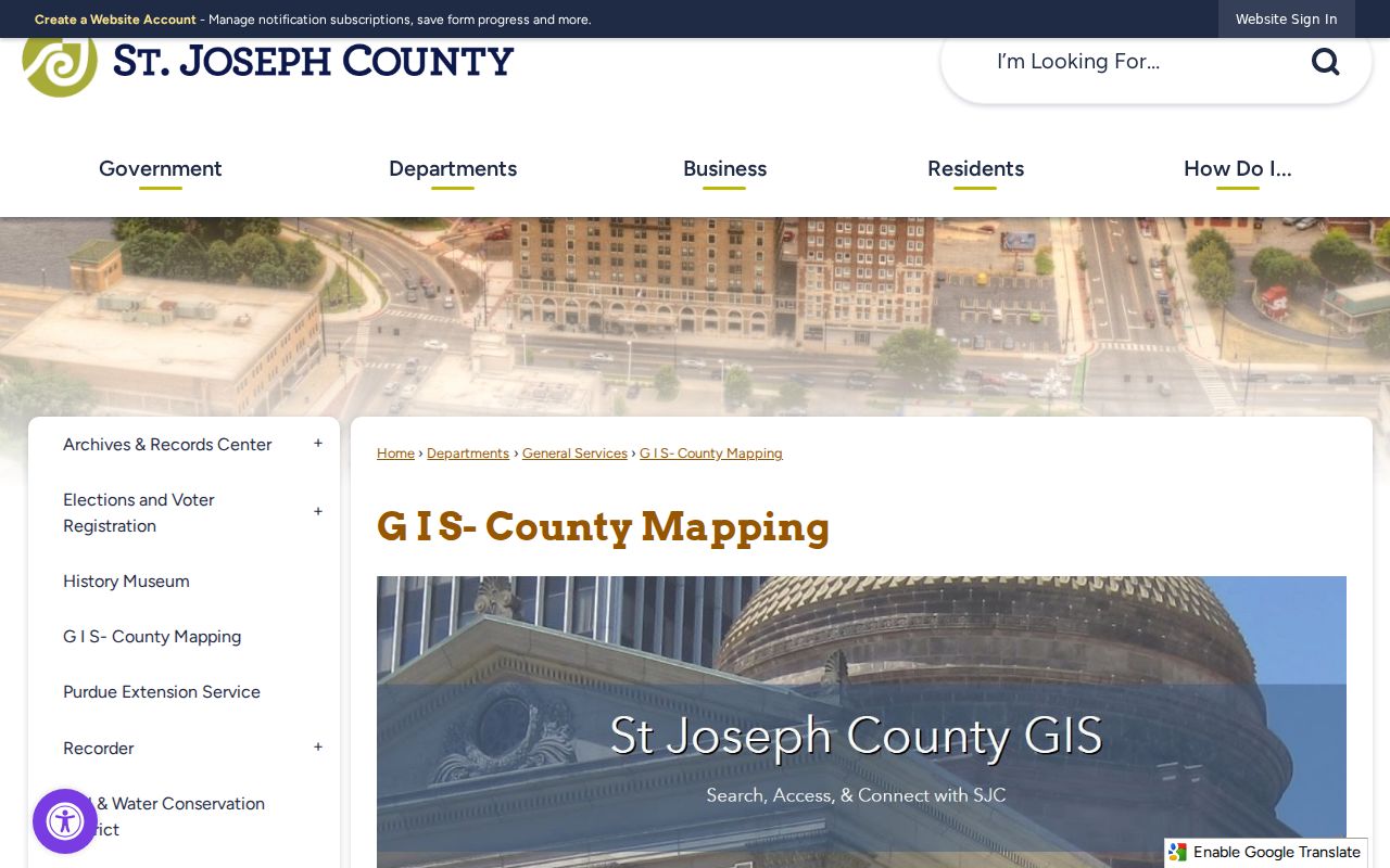
Use the parcel map to test the ZIP against city limits and townships, then use the Assessor and Recorder for the actual ownership record.
St. Joseph ZIPs Versus City Limits
Postal geography exists to route mail. Municipal lines decide which city government serves an address, while township, tax, school, election, and planning districts answer other questions. A 46530 Granger label does not create an incorporated City of Granger. Likewise, a South Bend postal label near an edge does not prove the parcel sits inside South Bend.
Resolve a mismatch in this order: USPS for delivery, county GIS for parcel and boundary, XSoft for situs and mailing fields, then the relevant municipal or county office. Historical directories and Sanborn maps may bridge an older street or rural route, but they are not modern ZIP evidence.
- ZIP and ZIP+4
- The five-digit delivery area and a more exact four-digit add-on for a delivery segment.
- PO-box ZIP
- A code used for post-office-box delivery; no separate county polygon was verified here.
- Unique ZIP
- A code assigned to one large organization or institution; no distinct local polygon was verified.
- Carrier route
- A group of addresses served by one postal delivery route, not a city or parcel boundary.
ZIP Filters Have Record Limits
Some state portals accept ZIP only as one filter. INBiz can filter entity filings by street, city, and ZIP. The Professional Licensing Agency search can filter credentials by city, county, and ZIP. Those results show business or license relationships, not every person in a postal area. Preserve the filing or license number, status, and date instead of treating the address as current residence.
Indiana voter registration records are generally public, but the individual portal is made for registration and polling checks, not ZIP-wide browsing. Full file requests use State Form VRG-24 and carry category, redistribution, and solicitation limits. Address Confidentiality Program data and other protected voter fields are withheld. A missing name may reflect protected status or a different search format, not absence from the county.
Boundary caution. A St. Joseph County ZIP code narrows delivery geography; it never proves a person's identity, residence, or municipal jurisdiction by itself.
Request St. Joseph Boundary Layers
When a public map cannot resolve an edge case, the county's Online GIS Data Request can ask for address points, centerline streets, annexations, city and town boundaries, civil townships, parcels, subdivisions, tax districts, voter precincts, and zoning. This is a request form, not an instant download. It asks for contact and project details plus the needed layers.
The form also lists aerial images from 1966 through 2025. A quarter-square-mile aerial tile costs $25, while a full-county layer requires a provisional data-use agreement and lists a $200 fee. Those historic images can explain a road edge or past layout, but they do not establish who lived there. Ask for the exact layer and date that explain the mismatch.
For a reproducible postal-area check, save the USPS result date, county map update, parcel ID, boundary layer, and assessment record. Also note which city, town, or township held the related file. That record trail shows why two labels differ without turning a postal shortcut into an unsupported claim about a resident.